Then and Now, Crawford County Ohio
Click photos to enlarge and compare.
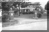 1924. Crawford. Transportation History Collection, Special Collections Library, University of Michigan.
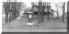 1924. Crawford. Transportation History Collection, Special Collections Library, University of Michigan.
Then and Now, Ashland County Ohio
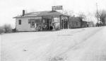
![]() In Rowesburg, Ohio. This is at a Sinclair gas station in 1926, looking east. Lincoln Highway Collection, Transportation History Collection, Special Collections Library, University of Michigan. This section of road was removed from the Lincoln Highway in 1928 when the road was re-routed in a more direct line from Wooster to Mansfield Ohio. This is now on Route 250. Note: These photos were used in the magazine "Ford Restorer" on 4/01 in an article about the Lincoln Highway.
In Rowesburg, Ohio. This is at a Sinclair gas station in 1926, looking east. Lincoln Highway Collection, Transportation History Collection, Special Collections Library, University of Michigan. This section of road was removed from the Lincoln Highway in 1928 when the road was re-routed in a more direct line from Wooster to Mansfield Ohio. This is now on Route 250. Note: These photos were used in the magazine "Ford Restorer" on 4/01 in an article about the Lincoln Highway.
 Five miles east of Ashland, Ohio near Studebaker Monument, 4/25/27. Lincoln Highway Collection, Transportation History Collection, Special Collections Library, University of Michigan.
Then and Now, Wayne County Ohio
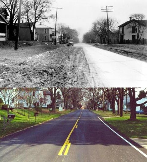 1924. At the west village limit looking east in Dalton, Ohio. Lincoln Highway Collection, Transportation History Collection, Special Collections Library, University of Michigan.
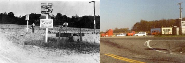
1945 Trailer Inn Truck Stop, Dalton, Ohio
Then and Now, Stark County Ohio
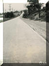
 1921. Before orange barrels. Paris Township Transportation History Collection, Special Collections Library, University of Michigan.
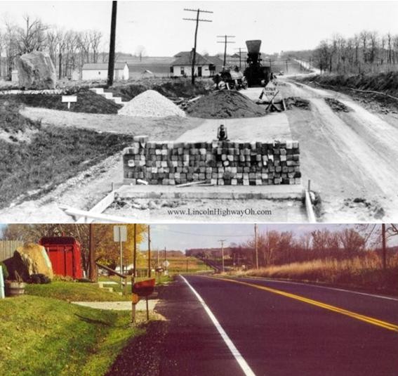
![]() 1924. Taken from the intersection of Sam Krabill and what is now known as Cindell St., between East Canton and Robertsville, Ohio The road was paved in brick and straightened just 4 years earlier. In the original photograph at the University of Michigan, the road is seen much deeper into the mist than this reproduction. It gives a great view of the road which has since been reclaimed as farm land. Lincoln Highway Collection, Transportation History Collection, Special Collections Library, University of Michigan.
1924. Taken from the intersection of Sam Krabill and what is now known as Cindell St., between East Canton and Robertsville, Ohio The road was paved in brick and straightened just 4 years earlier. In the original photograph at the University of Michigan, the road is seen much deeper into the mist than this reproduction. It gives a great view of the road which has since been reclaimed as farm land. Lincoln Highway Collection, Transportation History Collection, Special Collections Library, University of Michigan.
Cindell Street 2000, a brick section still in use. This road is one of the most valued pieces of the old Lincoln Highway to many members of the Lincoln Highway Association. Most of the residents of this road respect the historic value of the road despite it's slowly deteriorating condition. It was from this location, that the Webmaster first laid eyes on an original section of the Lincoln Highway while motorcycle riding, and a passion for the road was born. In 1928, a concrete marker was posted by the Boy Scouts at about this location.
![]() 1926. Four miles east of Canton, Ohio Transportation History Collection, Special Collections Library, University of Michigan.
1926. Four miles east of Canton, Ohio Transportation History Collection, Special Collections Library, University of Michigan.
1926. Four miles east of Canton, Ohio Transportation History Collection, Special Collections Library, University of Michigan.
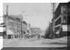 Year unknown. From Central Plaza, Canton, Ohio. Looking east.
From the collection of J n R Photographic Services
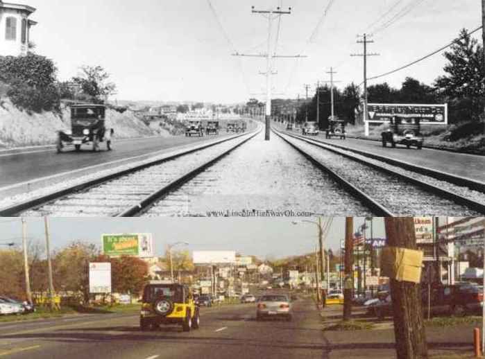
 1924 - West Tuscarawas Street in Canton, Ohio, near the intersection of Bellflower, was in the process of being widened. Note how the trolley tacks were going to be in the center of the road. An example of this in it's finished state can be seen in the comparison near Perry Drive. The trolley tracks in the center of the road made it possible to have a 5th turn lane as seen in the bottom picture. Transportation History Collection, Special Collections Library, University of Michigan.
 1924. This arrangement of trolley in the middle lane in Perry Township made possible the wide 5 lane road as seen in the second picture. Transportation History Collection, Special Collections Library, University of Michigan.
Year unknown. Downtown Massillon looking east.
From the collection of J n R Photographic Services
Then and Now, Columbiana County Ohio
 1924. Two miles west of Lisbon, Ohio. Much of the fill was probably taken from the cut in the top of the photo. Transportation History Collection, Special Collections Library, University of Michigan.
 1924. Three miles west of Lisbon, Ohio. Note the old alignment and bridge on the right. Transportation History Collection, Special Collections Library, University of Michigan.
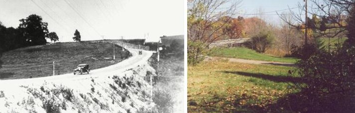
![]() 1921. West of Lisbon, Hanover Township in Columbiana County Ohio near Richie School Road. Note the original bridge and road below the new bridge. Traces of this road remain today. Transportation History Collection, Special Collections Library, University of Michigan.
1921. West of Lisbon, Hanover Township in Columbiana County Ohio near Richie School Road. Note the original bridge and road below the new bridge. Traces of this road remain today. Transportation History Collection, Special Collections Library, University of Michigan.